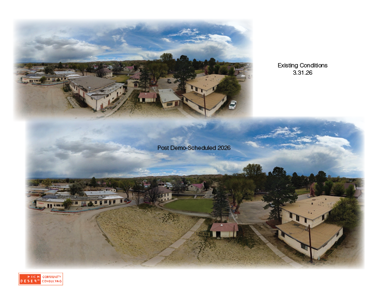
Drone Imagery: Photography and Videography
Drone imagery offers an affordable and highly effective way to understand a site from an entirely new vantage point. By capturing real-time aerial perspectives, it reveals patterns, relationships, and opportunities that are often missed at ground level—whether assessing terrain, visualizing project impacts, or communicating ideas to stakeholders. For High Desert Community Consulting, drone imagery is a practical tool for “getting a different perspective,” helping communities and project teams see their landscapes more clearly and make more informed, confident decisions.